
All models are wrong, but some are useful
George E. P. Box
CREST hydrologic model
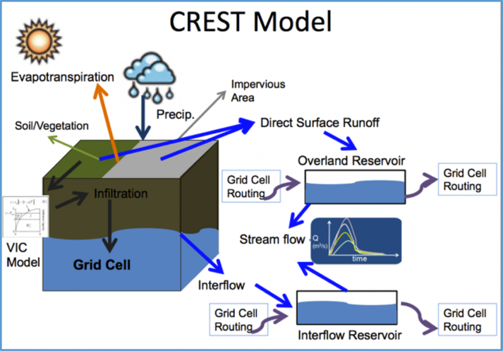
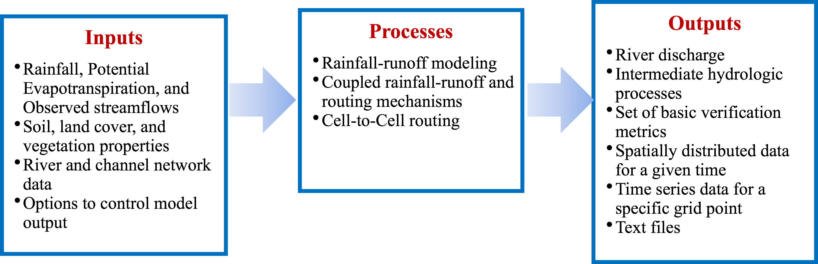
The CREST model stands for Coupled Routing and Excess STorage. It is a hydrologic model that was developed jointly by the University of Oklahoma and NASA. It was the first model that supports the global flood monitoring system operated at NASA; it was the first model coupled with National Mosaic Quantitative Precipitation Estimation, operated at NOAA NWS. It is the first model that supports the real-time operational flash flood monitoring system, operated at NOAA NSSL.
Since published in 2011, the CREST model has been continuously evolving and growing. By 2021, it has three main updates and many others coupled with different environmental models to address water-related natural hazards.
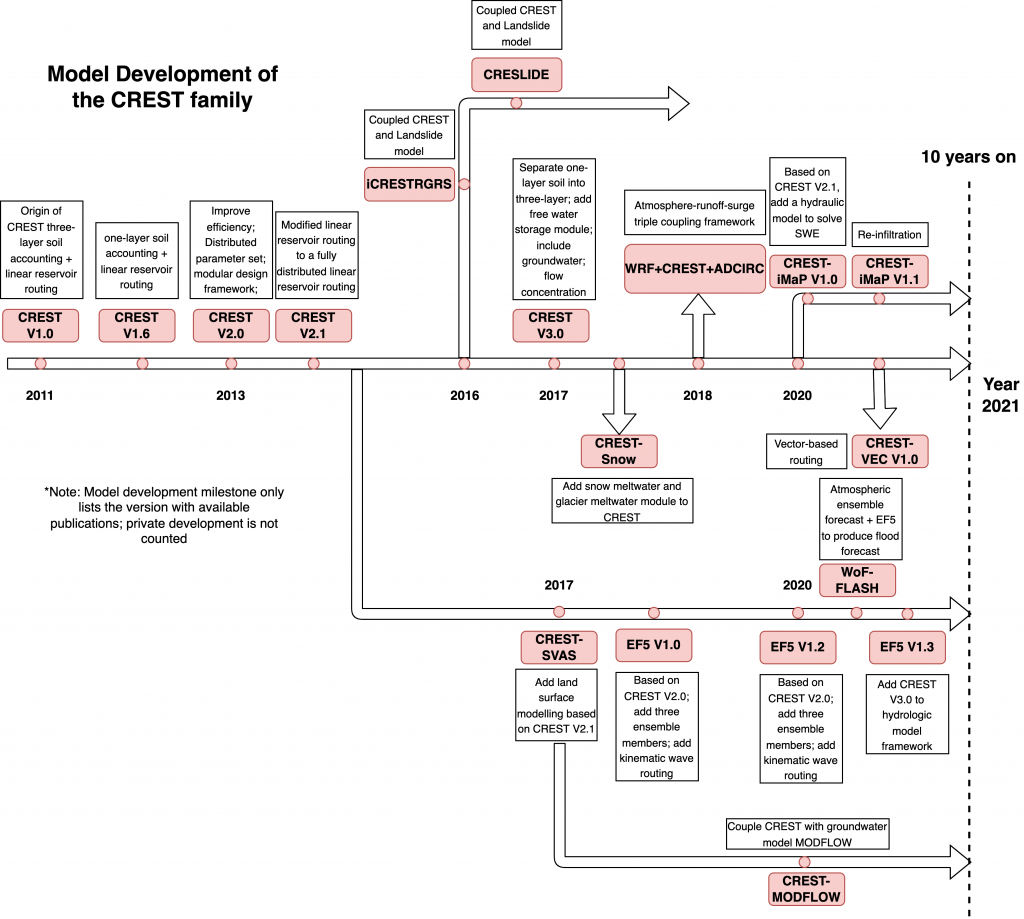
CREST-VEC
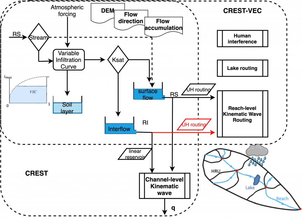
The CREST-VEC model is a vectorized version of CREST model. It is intended to improve the efficiency and accuracy of streamflow simulation across scales. It was developed by Dr. Z at the University of Oklahoma.
CREST-iMAP
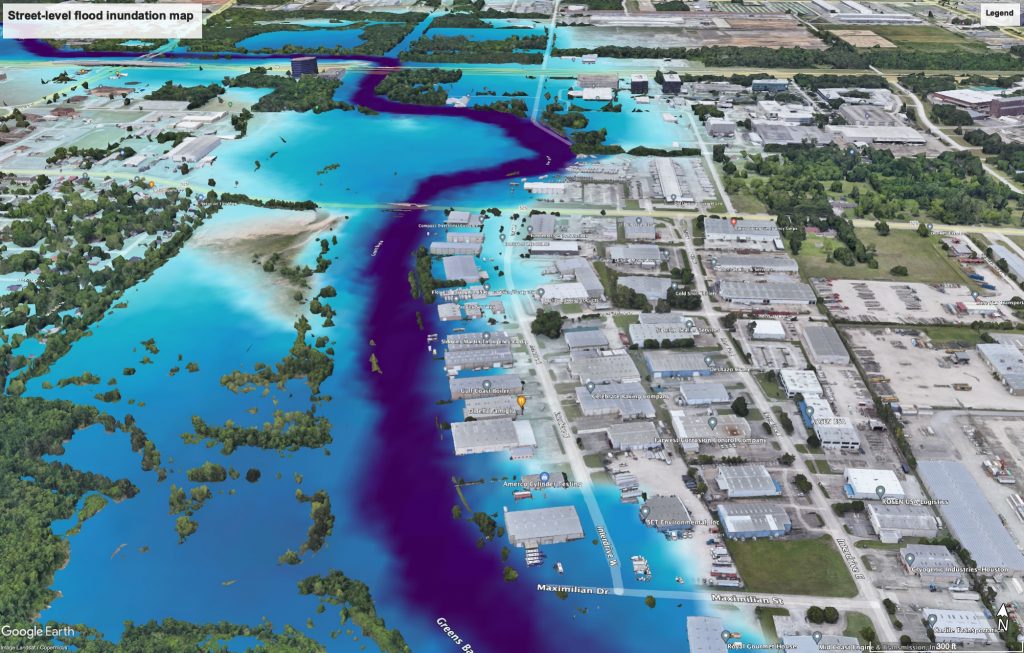
The CREST-iMAP, short for CREST-inundation MAping and Prediction, is a hydrologic-hydraulic model for 2D flood prediction. It solves the Shallow Water Equation in a full format using a finite volume approach.